
There are actually two South rivers that originate in Augusta County. One begins as St. Marys River and flows south into the Maury River, but the one featured on this webpage starts near the village of Greenville and flows approximately 50 miles north and joins the North River to form the South Fork Shenandoah River. Upstream of the City of Waynesboro, South River can be characterized as a small, low-gradient, meandering stream. As it approaches Waynesboro, large springs begin to cool the river, increase flow, and increase productivity. The South River offers both warmwater and coldwater (trout) fishing opportunities.
Warmwater Fishing
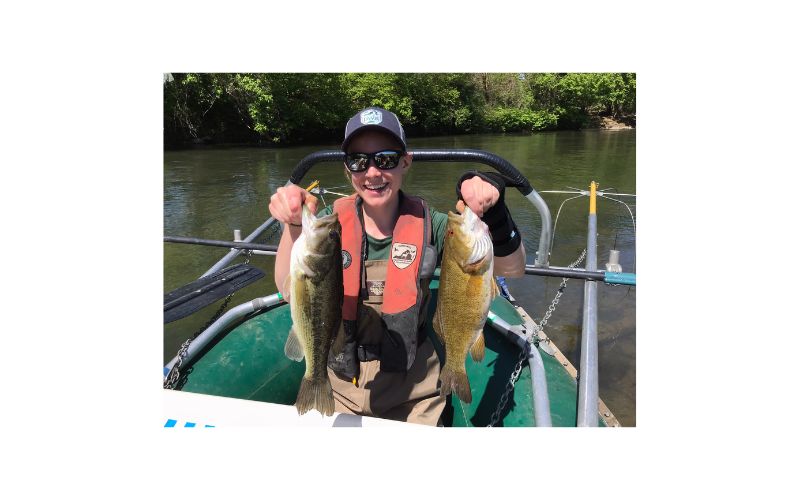
The river harbors good numbers of smallmouth bass, redbreast sunfish, rock bass, fallfish and even a few largemouth bass from near Lyndhurst downstream to the confluence with the North River in Port Republic. Anglers might also catch bluegill, green sunfish, channel catfish, carp, white sucker, or black crappie while exploring the river.
Trout Fishing
There are five separate sections of South River that fall under different trout management programs and are managed with different regulations. They are listed in order from upstream of Waynesboro downstream to Grottoes.
- In the Lyndhurst area upstream of Waynesboro Trout Unlimited has partnered with several private landowners to open a 3 mile section of stream to public fishing. This section is stocked annually with fingerling rainbow and brown trout by VDWR. Regulations are fly fishing only and all trout <20 inches must be released. Only one trout >20 inches may be harvested per day. A free permit is required to fish this section.
- The section of South River within Ridgeview Park in the City of Waynesboro is managed as a Designated Stocked Trout Water.
- The 2 mile reach from Wayne Avenue downstream through Constitution Park to 2nd Street in North Park in the City of Waynesboro is managed as a Catch and Release Stocked Trout Water. A “greenway” walking trail parallels the stream for the upper half of this section.
- A ¼ mile reach of South River within Basic Park (City of Waynesboro) is a Youth Only Stocked Trout Water April 1 – June 15. Only youth age 15 and younger can fish during this time period.
- The reach from Grand Caverns Park downstream to Grottoes Town Park is managed as a Designated Stocked Trout Water.
Maps & Directions
Float Trips
Constitution Park to North Park or Basic Park
Paddlers can put in at Constitution Park near the Main Street bridge, and float one mile to North Park Map or 1.7 miles to Basic Park Map. This float is characterized by an urban setting with homes and industry lining the banks. Trout fishing is good through this reach, though, so be sure to carry your trout license with you from October 1 – June 15. Smallmouth and Sunfish can also be targeted anywhere you can find a deeper run with rocky structure.
Basic Park to Dooms Map
This is an average float of 3.0 miles, characterized by gentle riffles and rolling farmland. This section of river is gentle and winding with numerous deep pools. The numbers of bass and sunfish start to increase during this float as the habitat transitions away from shallow riffles and runs to deeper glides and pools. Target trout at the beginning of the float near basic park and then transition to bass and sunfish as you float further downstream. Enjoy the newly renovated Dooms Boat Access. Reminder: At the Dooms put in, there is a 280ft section of path that you will need to carry your boat and gear. The path is level providing an easy walk to your vehicle.
Dooms to Crimora Park Map
This is a longer float of 5.0 miles. Enjoy the newly renovated Dooms Boat Access. Reminder: At the Dooms put in, there is a 280ft section of path that you will need to carry your boat and gear. The path is level providing an easy walk from your vehicle. Stray trout can be caught (no trout license needed here), as well as smallmouth bass, rock bass, and redbreast sunfish. This section of river starts out in farmland, but eventually ends in secluded woodlands. The river tightens and the habitat for fish improves. Anglers can expect better catch rates throughout this reach. Reminder: At the Crimora Park put in, there is a 435ft section of path that you will need to carry your boat and gear. The path is level providing an easy walk to your vehicle.
Crimora Park to Grand Caverns Map
This is a very long float around 10 miles long. Reminder: At the Crimora Park put in, there is a 435ft section of path that you will need to carry your boat and gear. The path is level providing an easy walk from your vehicle. Also, in the past, some paddlers used the Harriston bridge to trim down this float. However, the Harriston bridge is private property and should not be accessed without landowner permission. Throughout this section the river winds through a beautiful reach of forested riverbanks and farms, with very good fishing opportunities. Smallmouth bass fishing gets better in this river reach due to excellent habitat and good water quality. It may be a long float, but it is one of our favorite stretches on the South River. Anglers should exercise some caution on this float during higher flows (300CFS+). The tighter sections of this reach can be difficult to navigate. Reminder: There is a steep wall of rip rap that is used as the takeout at Grand Caverns. The boulders act as steps to access the river, but can be challenging to some river users.
Grand Caverns to Grottoes Town Park Map
A short float of 2.1 miles. Reminder: There is a steep wall of rip rap that is used as the put in. The boulders act as steps to access the river, but can be challenging to some river users. This is also one of the more challenging pieces of South River. 0.4 miles downstream boaters will enter a sharp “S” bend. This area has numerous boulders, and at times, log jams. Paddlers should use caution even at lower water levels. As the paddler approaches Grottoes, large upright thrusts of limestone create some Class 2 rapids (at higher water levels). The Department stocks trout from Grand Caverns to Grottoes, so a trout license is needed when floating this reach (October 1 – June 15). Some quality largemouth bass and large carp can be caught in this section. The Town of Grottoes has developed a beautiful park on river right, complete with a DWR boat landing.
Grottoes to Port Republic Map
This is also a short float of 2 miles, so it can be combined with the Grand Caverns float to make a longer fishing trip. This is an easy paddle, but the channel has become quite braided. This reach should be avoided at lower water levels. Take out is at the DWR boat landing on river right as South River joins North River to form the South Fork Shenandoah River.
Fishing
Special Regulation Trout Fishing:
Lyndhurst: Map
Put-and take trout fishing:
Ridgeview Park, Waynesboro: Map
Grand Caverns Park: Map
Grottoes Town Park: Map
Catch and Release trout fishing:
Constitution Park, Waynesboro: Map
North Park, Waynesboro: Map
Youth Only Stocked Trout Fishing:
Basic Park, Waynesboro: Map
Smallmouth bass, largemouth bass:
From Constitution Park to Port Republic
Biologist Reports
Regulations
Statewide Freshwater Fishing License required year-round.
Special Trout License required October 1st through June 15th.
Creel Limit: 6 trout per day
Size Limit: 7 inch minimum
Catch and Release Trout Area in Waynesboro between Wayne Ave. and North Park
Statewide Freshwater Fishing License required year-round.
Special Trout License required October 1st through June 15th.
Catch and Release, no bait, single hook artificial lure only, year-round
Youth Only Stocked Trout Area
Basic Park, Waynesboro
April 1 through June 15
Youth age 15 and under only
Creel limit: 3 trout per day
Warmwater Fish
(entire river)
Smallmouth bass, largemouth bass:
Creel Limit: 5 per day combined
Size Limit: None
Sunfish, rock bass:
Creel Limit: 50 per day combined
Size Limit: None
There is a fish consumption advisory (mercury) for all species in South River, except for trout. It is recommended by the Virginia Department of Health that no fish be eaten from this river except trout. For more information go to:
Virginia Department of Health
News
Mercury contamination has plagued South River from 1929 until present from Waynesboro to Port Republic. Scientists and citizens from academia, industry, government, and NGO’s have pooled their resources to try to understand how this pollutant behaves in South River. Starting in 2000, the South River Science Team studied many biological, chemical, hydrologic, and physical aspects of the river in an attempt to reduce the risk of mercury contamination to humans and animals. Although the science team has since disbanded, research continues to take place in an effort to reduce the contamination.
The Grottoes Police Department and DWR co-sponsor Chief Charlie’s Kid’s Fishing Day every spring at Grottoes Town Park. Fishing, food, and fun are FREE to kids 15 years and younger. See listing of DWR sponsored kid’s fishing days link for more specific information.
Riverfest is also held every April in Constitution Park in Waynesboro. This event is a community celebration of South River and is full of food, exhibits, demonstrations, canoe rides, and art. Their website is: Riverfest
Grand Caverns is home to some of the most intriguing caves in Virginia. For more information: Grand Caverns
A brand new boat access was constructed just upstream of the bridge in the town of Dooms. The old dam wreckage was also removed from the river, which facilitates safe passage for boaters.
Facilities, Amenities, and Nearby Attractions
There is a universal fishing pier as well as restroom facilities at Ridgeview Park in Waynesboro. North Park, Grand Caverns, Grottoes Town Park, Constitution and Basic Park all have restrooms. There are DWR boat landings at Grottoes Town Park, Port Republic, Constitution and Basic Park. A family park has recently been built by Augusta County Parks and Recreation at Crimora. A landing was also constructed in the town of Dooms.
More Information
For additional information, contact:
VDWR
Fisheries Biologist
517 Lee highway
Verona, VA 24482
Phone: (540) 248 – 9360